
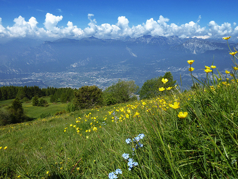
Mount Stivo, 2,054 m high, divides the Sarca Valley North of Benaco from Vallagarina. Who reaches its peak in late spring, will be surprised by the botanical riches of its lawns.
The starting point of our spring hike is the località Sant'Antonio over the pass of Santa Barbara, reachable by Bolognano di Arco or from Val di Gresta (Ronzo Chienis). The parking lot is located just beyond the Bar s. Antonio surrounded by woods and fields. We follow the trail no. 608 B, that the asphalt goes to unpaved to the meadows of "Jacks".
Here, at 1450 m a.s.l., begin the pastures of Monte Stivo, who will accompany us to the Summit. We follow the path up, higher and higher, to reach the Summit, immediately after passing near the refuge. From the top you see from one side of the Adige Valley with Rovereto and surroundings, and the other the Sarca Valley with Riva del Garda and Arco.
After a pause at the shelter, we descend the trail n. 608, which reaches up to Malga Stivo, then carry on off riding path up to the outlets, where we, on route, parking in San Antonio.
Caution: before you embark on this hike learn about trail conditions.
Starting point: St. Anthony above Step Santa Barbara
Location: St Anthony-Le Prese-Ref. Marchetti Stivo-vetta Monte Stivo-Malga Stivo-Le Prese-s. Antonio
Length of tour: about 8.5 km (total)
Time required: between 3.5 and 4 hours
Difference in altitude: 835 m
Altitude: between 1230 and 2,054 m a.s.l.
Source: www.tr3ntino.it